I believe that the next generation of transportation management solutions will leverage GPS and telematics technologies in much more robust ways than we are seeing today.
For example, I was recently briefed by Esri, which provides Geographic Information Systems (GIS) and a platform/toolkit called ArcGIS that allows users to combine geographic data, including real-time and historical GPS data, with applications based upon relational databases. I feel more certain now that companies can do more interesting things with a TMS solution based upon the use of GPS and GIS.
Esri also provides a routing engine (not an application) that can be built into other TMS solutions. Or it can be used by large companies to build their own routing/tracking solution. This routing engine has some nice features. For example, it can create routes in metropolitan areas that have no left turns. UPS received some publicity when it announced this capability for its proprietary routing solution. When you have to make a left turn in an urban area, you can sit at a light while your vehicle idles. UPS claims that its routing technology allowed it to avoid 98 million minutes of idle time last year. UPS has 100,000 ground vehicles, so any savings from routing enhancements has a way of adding up. I could not recall other providers of off-the-shelf fleet management and routing solutions having this capability, but in a recent briefing with Roadnet Technologies, the company told me its solution has this feature too. In fairness, other routing solution providers make the point that this functionality matters most for extremely high stop count routes and does not apply to many, even most, routing problems.
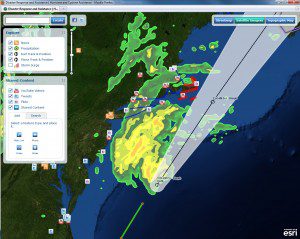
The Esri platform also allows risk management analysis to be combined with supply chain applications. For a TMS, what this means, for example, is that if the National Oceanic and Atmospheric Administration (NOAA) says that a big snowstorm is going to dump several inches of snow in western Colorado beginning at about 3AM on Jan 7th and ending at noon on the 9th, that data could be imported into arcESRI. The combination of Esri’s solution and a TMS could then provide automatic alerting. The joint solution could uncover every truck routed through that region and alert planners that those trucks need to be immediately rerouted around the snowstorm.

Another nice feature demonstrated by the Esri platform is dynamic geofencing. In GPS-enabled fleet management solutions, a geofence is a virtual barrier surrounding a truck. The most common form this takes is to look at the route a truck is supposed to take to a destination. If the truck moves more than a quarter mile, for example, off the designated route as tracked by the GPS, then a real time alert is sent to a manager.
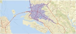
Esri extends this functionality in an interesting way. What Esri allows is for a destination to be designated, for example, as a warehouse drop-off point. Warehouse planners may want to know, for example, when an inbound truck is within 15 minutes of arriving. If it is a hot load, they can start repositioning people to immediately unload the truck. Again, the real time GPS tracking is what allows this to occur. But what is interesting is that the size of the geofence changes over the course of the day. During rush hour, the geofence is much larger, while at night it is much smaller. Historical GPS data is used to allow this dynamic geofencing. These types of geofences look very different on a map. The classic geofences are narrow ovoid type figures; traffic-driven geofences are jagged pentagonal figures.

In conclusion, I do believe that next generation TMS solutions will find much more interesting ways to leverage GPS and telematics data. GIS solutions will clearly play a role in facilitating this by automating the way geographic data is linked to the application data that resides in relational databases.


Leave a Reply